After some great weather since our arrival it looked like rain today which meant that we needed to wear our wet weather gear. This mean waterproof jacket, waterproof pants and hat. I can say that once dressed I looked so hip that I would've made a fashion statement on the catwalks of Paris along with my cap which was adorned with a shower cap, this was to keep the rain off my glasses, pretty ingenious !!!
We set out again with all our equipment, (radio tracking equipment, measuring taps, data sheets, clinometer's, metal tree tags and nails). Once we arrived at our makeshift base camp we split up into 2 groups to commence the tracking of the koala's which we previously radio collared the day before.
Our group set out with Alistair who would provide us with on the spot training on how to track the Koala's. Our team had an antenna, data sheets and GPS. Firstly I needed the frequency to enable me to find the koala's, this was done by tuning the frequency to the radio collar of the koala that we wanted to locate. For example - the previous day we put a collar on a Koala which had a number of 380, this is number that I tuned the GPS to locate the koala. Once this was done I needed to hold the antenna up high and listen for the signal. This meant that I needed to complete a circle and listen from where the beep was the loudest, I would follow the signal until it was very loud which meant that I had located the koala. Sometimes there was more that 1 koala in the same tree which meant that I needed to use binoculars to see if one of the koala's located had a collar and if so, I knew that I had identified the right koala. There is a definite skill in using the GPS to track Koala's especially if there is a group of 3 or 4 koala's in the same location you really need to use your listening skills, then your observation skills to ensure that the correct koala is located as the data collected needs to be correct when being collated.
Once the correct koala had been identified in the tree data sheets needed to be completed. Data collected was, which tree the koala was located in, how many other koala's in the immediate area less than 20 metres away, what was the koala doing ie sleeping, rest awake, active, eating). The reason why this data needed to be collected was to get an understanding if the koala's were moving if so, how far and to which tree, how long they stayed in the same tree, and what activity they were doing at the time.
 |
Sleeping |
 |
| Sleeping |
 |
| Rest Alert |
This data gathered over a period of time would show the range of how often the koala would move, how often the koala would move, the size class of the trees the koala's were using, the activities the koala was doing and when do they do these activities. All this data would then be entered into a database which would allow us to understand koala behaviour in more detail and allow this data to be compared with other koala data collected in Queensland.
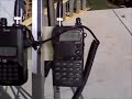 |
| GPS Frequency Tracker |
 |
| Radio Antenna |
The tracking would need to be completed twice daily morning and afternoon for the rest our expedition using the same procedure and ensuring that all information was collected on our data sheets.
By lunchtime it was raining, one good thing was that it kept the mosquito's away yeah!!!! The downside we were wet. Oh well the work must go on. It was time to commence the measuring of the tees. This sounds fairly easy however, you soon learn that sometimes the tree is so large that hugging it can be quite difficult.
Measurements included tree species and composition, tree density and tree size (DBH - Diameter Breast Height, height, canopy area). Canopy condition of each tree would be assessed through photo points and visual assessment of canopy cover.
We began to place a metal tag on each tree that had been previously been identified where our radio collared koala's had been first located on the first day of our field work. The tree number was marked on the metal tag and tag hammered into the tree to allow for easy tree identification.
The measuring of the tree involved measuring the diameter of the tree base at breast height including how many arms to the tree. The height of the tree was measured by a clinometer.
 |
| Clinometer |
We also needed to measure the canopy of the tree. This required the tree to be divided into 4 quadrants, north, south, east and west. It was interesting to note that the condition of the trees was quiet poor. By the end of the day we had measured 35 trees, by the end of the expedition we had logged up to 48 trees.
The mapping of the trees will allow for other groups who come to this area to know and identify the trees and capture other data.
 |
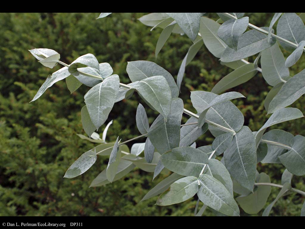
| Manna Gum - Sparse Canopy |
In addition on this day we also deployed motion-triggered remote camera's. The information once downloaded allowed for viewing of images that would also capture small mammal diversity in addition to the movement of koala's.
The rain did not stop during the day and we were all wet and cold. We collected all our gear and made our way back to our cabin. Exhausted from a full day of work we rested, cooked tea and watched TV. We were so excited the next day would be our day off. Yes we had a day to ourselves, we could do whatever we wanted and first on the agenda would mean that we all would sleep in and take our time with breakfast.